
"Mound F is the northernmost mound on the site, and measures roughly 780' from north to south by 970', from east to west. At the time of General Cunningham’s visit the height of this mound was 2.5 to 30 feet above the surrounding land, and it is still about the same."
- Daya Ram Sahni, Annual Progress Report of the Archaeological Survey [of India], Hindu and Buddhist Monuments, Northern Circle for the Year Ending 31st March 1921, p. 9.
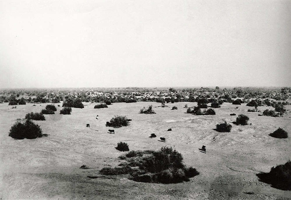
"Mound F, where work has been continued during all the eleven years and which claims nearly half of the excavations on this site, stands on the south bank of the Sukhrava,1 a dry bed of the Ravi, and is the northernmost of the western line of mounds. It is roughly rectangular in shape, measuring approximately 970 ft. from east to west and 780 ft. from north to south. At the highest point, it rises to a little more than 550 ft. above the mean sea-level as coordinated with the bridge over the lower Bari Doab canal on the road to Harappa Railway Station, or about 30 ft. above the level of the dry river bed (PI. I). Almost bisecting the mound from north to south, there is a broad, raised belt ranging in height from 540 to 545 ft. from which the surface slopes down to 530 ft. on the east, to 535 ft. on the north-west, while in the south-west portion of the mound the ground level is more or less the same as that of the central belt."
- Madho Sarup Vats, Excavations at Harappa, 1940, p. 17.
"This is a view of Mound F as seen from the slope of the much higher northern edge of Mound AB. In the foreground are erosional gullies extending off of Mound AB and a road that connects the hamlet known today as Dhudhi Village to the left (west) with the modern city of Harappa to the right (east). This road follows what would have been an ancient road between the higher Mound AB and the lower Mound F. The dark line of trees at the edge of the mound is where the dry bed of the ancient Ravi River once flowed. It is now called the "Sukh Rava" or "Dry Ravi" but every year during the monsoons it is flooded and provides excellent farm land. For a modern view from the same angle see Mound F, Harappa."
- Jonathan Mark Kenoyer, 2021.
The 2003 excavations in this area led by Drs. Richard H. Meadow and Mark Kenoyer are in the slide section Mystery at Mound F.
1. Literally dry Ravi.↩