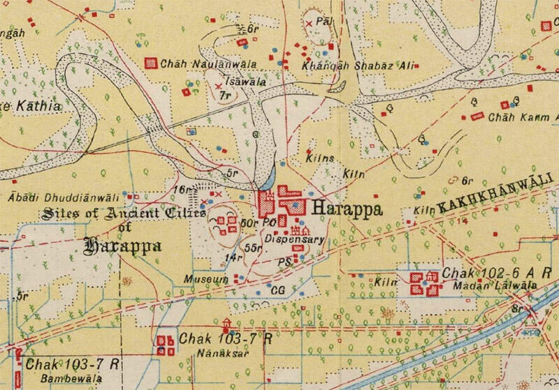
Science is slowly transforming ancient Indus studies, from DNA analysis of skeletons that point to migration and disease, to isotope analysis that reveals the distant origins of raw materials. One of the cleverest – and potentially rewarding i terms of increasing the number of ancient sites to investigate – must be the use of old maps like (to quote from the abstract) "the Survey of India's 1" to 1-mile map series, which was based on surveys started in the mid–late nineteenth century, and published progressively from the early twentieth century AD. These maps present a systematic documentation of the topography of the British dominions in the South Asian Subcontinent. Incidentally, they also documented the locations, the height and area of thousands of elevated mounds that were visible in the landscape at the time that the surveys were carried out, but have typically since been either damaged or destroyed by the expansion of irrigation agriculture and urbanism." As they later put it, to our immense benefit today, "irrespective of whether the surveyors knew that they were recording archaeological sites, it is clear that the Survey of India 1” to 1-mile maps provide a major data source for identifying and locating mound shaped features that might be archaeological mound sites in advance of on-the-ground survey projects." (p. 13)
Using computer tools and setting parameters based on old map-makers drawings and signs, the researchers were able to identify almost 9000 mound features (!) in about 2/3rd of the map sheets, an amazing number by any standard, and in one area around the present-day site of Rakigarhi their work "resulted in the identification of in excess of 200 archaeological sites with a delimited study area that were previously unknown" (p. 20). This is nothing short of a stunning achievement, and a pointer to how many clues may yet lie in the archives.
The writers also use a nice, rare word in the article, "ground-truthing" to refer to actually going and checking in the real world whether something that an old map or remote sensing has indicated should be there. Given how quickly the landscape across India and Pakistan is and has been transformed by rapid construction, this work shows that there might still be ways to identify places where excavations might or could be done one day.
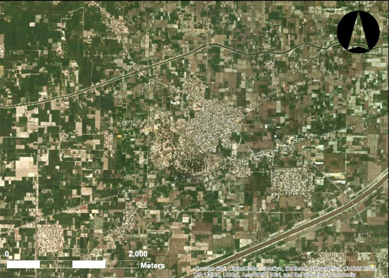
Image: (above) Detail showing documentation of the “Sites of Ancient Cities of Harappa”, including depiction of mounds delineated by ‘form-lines’, graves, and ‘x’ signifying deserted villages, and their relationship to the modern town (44/B14/1933) (Image courtesy of Cambridge University Library); (below) ESRI world imagery of the same region today.
A companion article, to be reviewed here next week, on the 1909 floods of Dera Ghazi Khan, applies some of the principles of this paper and is available at https://www.mdpi.com/2076-3263/9/1/21


