
"The mounds at Harappa are a prominent landmark in the countryside visible long distances away. They were visited by Masson in 1826, by Burnes five years later, and by General Cunningham twice in 1853 and 1856. Burnes estimated the extent of the ruins as "about three miles in circumference, which", savs Cunningham, “ is one-half too much, as the actual ruined mound forms an irregular square of only half a mile on each side or two miles in circuit. But this comprises only the remains of the walled town, to which we may fairly add the suburbs, or fields now covered with the broken bricks or other remains, which would bring the size of the old town quite up to Burnes’s estimate.”2 Cunningham published a plan of the mounds together with an account of what he saw in 1853 and again in 1856 in his Annual Report for 1872-73.3 “On the north, the west and the south”, says he, “there is a continuous line of mounds about 3,500 feet in length, but on the east side, which is only 2,000 feet in length, there is a complete gap of 800 feet, for which I am unable to account. The whole circuit of ruins is, therefore, about 12,500 feet or nearly 2 1/2 miles. The highest mound is on the north-west, which is 60 feet above the fields. On the south-west and south the mounds range from 40 to 50 feet in height, and on the north side towards the old bed of the Ravi, from 25 feet to 30 feet.” Cunningham traced the remains of flights of steps on both the eastern and western faces of the high mound at the north-west, as well as the basement of a large square building. This part has been designated on his plan as AB. None of these structures is traceable now, though the tomb of Naugaza and the ruined Id-gah [mosque] are still to be seen on the eastern slope of the mound. Cunningham also saw on the south face of the southern mound, designated E4 on his plan, the traces of a large square building with rooms on four sides surrounding a courtyard, the walls of which were said to be very massive."
- Madho Sarup Vats, Excavations at Harappa, 1940, pp. 2-3.
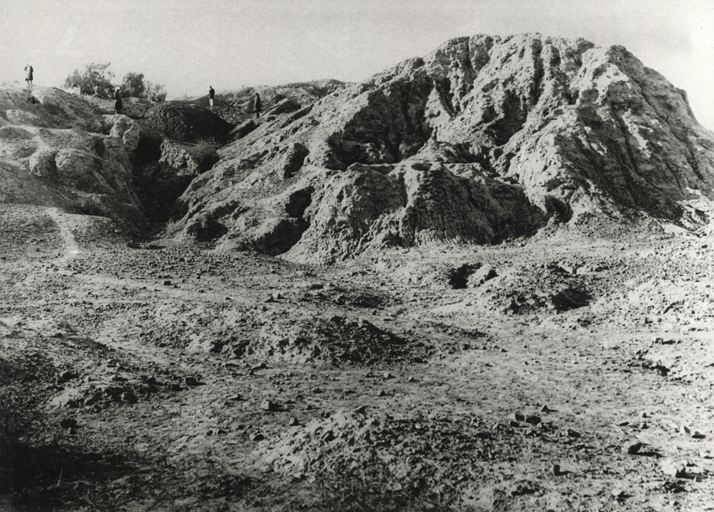
"The eroding mudbrick bastion on the northeastern corner of Mound AB seen from a different angle."
- Jonathan Mark Kenoyer, 2021.
1. Several specimens of this implement are reproduced in General Cunningham’s Archaeological Survey Reports, Vol. V, plate XXXIII.↩
2. Cunningham, Ancient Geography oj India, 1924 Edition, p. 242.↩
3. C. S. if., Vol. V. pp. 105-108.↩
4. To avoid confusion Cunningham’s nomenclature has been adopted on the plan of Harappa PL I.↩