Home

Main navigation

  • home
  • slides
  • essays
  • articles
  • books
  • video
  • q & a
  • blog
Secondary menu
  • about us
    • scholars
    • privacy
    • support
    • image rights
    • credits
    • contact us
  • resources

Maps

Ancient Indus civilization maps including sitemaps.

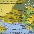
Major Sites and Interaction Networks

This map shows the networks that connected urban centers such as Mohenjo-daro and Harappa during the Harppan Period (2600-2000 BC) with their hinterlands and distant resource areas.In addition to these two cities, other known urban centers include D… >

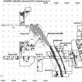
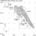
Harappa 1993-2001 Mound E/ET plan

Plan view of the east side of Mound E and the west side of Mound ET showing areas excavated between 1993 and 2001 (Trenches 9, 10, 11). The massive perimeter wall of Mound E encloses architectural remains of Harappa phase Periods 3B and 3C and proba… >

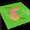
Period I Cultural Stratigraphy

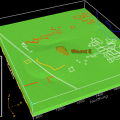
Using maps and cross-sections of the cultural deposits from HARP, surfaces were generated to represent the interfaces of cultural layers in the mounds at Harappa. This represents the growth of the city of ancient Harappa vertically and through time… >

Late Harappan Localization Era Map

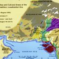
This map shows the major cultural interaction regions c. 1900-1300 BC: Cemetery H in the north, Jhukar in the south and Rangpur in Gujarat. During this period there were still urban centers in the Punjab and Sindh, but there was a breakdown in trade… >

Cross-section through debris deposits

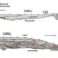
Cross-sections inside (top) and outside (bottom) of perimeter wall [250]. The wall itself, being of mud-brick, was heavily eroded, sometimes to a lower elevation than the adjoining more densely packed street debris. As can be seen in the bottom cros… >

Period II Cultural Stratigraphy

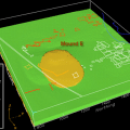
Period 2 deposits represent a transition phase between pre urban and urban phases and exist primarily beneath Mound E. >

Changing Settlement at Harappa

The earliest settlement, during Period 1 (c. 3300-2800 BC), was on the west side of Mound AB and NW corner of Mound E. During Period 2 (c. 2800-2600 BC) all of Mounds AB and E came to be occupied, and by the end of Period 3 (c. 2600-1900 BC), the Ha… >

Plan of Mound E perimeter wall segment

Plan view of the portion of perimeter wall [250] excavated in 2001. The pattern of the bricks suggests a complicated series of additions to the inside of the structure that are not yet well understood. There may have been a gateway at the northweste… >

Period IIIA Cultural Stratigraphy

Period 3A deposits, representing an early urban phase, exist beneath Mounds E and also show expansion onto the area beneath Mound AB. Growth in the city of Harappa is shown to be both lateral and vertical. >

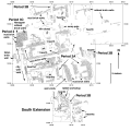
Trench 54 top plan

Overall Plan of Trench 54, showing the location of features noted in the previous slides. >

Pagination

  • Page 1
  • Page 2
  • Page 3
  • Page 4
  • Page 5
  • Next page
  • Last page
© Harappa.com 1995-2026 31