Home

Main navigation

  • home
  • slides
  • essays
  • articles
  • books
  • video
  • q & a
  • blog
Secondary menu
  • about us
    • scholars
    • privacy
    • support
    • image rights
    • credits
    • contact us
  • resources

Maps

Ancient Indus civilization maps including sitemaps.

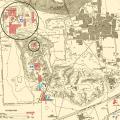
Mounds AB + F

  • map shows both Mound F and Mound AB

This map shows both Mound F and Mound AB, in grey circles, within the context of the larger site excavations. Objects that follow were found in both or either of these two areas and which in particular may not be available in the archival record. … >

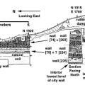
Mound F Harappa Section drawing

  •  Mound F Harappa Section drawing

Section drawing of the cut through the Mound F city wall and adjoining interior street, facing east (Trench 41NE). >

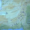
Distribution of Londo sites

  • Distribution of Londo sites

Map: Distribution of Londo sites (without Makran and Iran). >

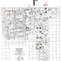
Plan of Vat's excavations showing circular platforms

  • Plan of Vat's excavations showing circular platforms

Plan of Vat's excavations showing circular platforms. In some cases remnants of the baked brick walls that probably surrounded each platform can be seen on the plan, although earlier and later walls are also shown. From M.S. Vats (1940) Excavations … >

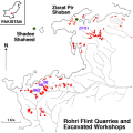
Rohri Map

  • Rohri Map

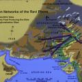
Interaction networks of the Ravi Phase

  • Interaction networks of the Ravi Phase

Arrows extend from Harappa to likely source areas for raw materials such as agate, lapis lazuli, steatite, marine shell and copper. These raw materials were transformed into ornaments and tools at Harappa for local trade. The Ravi Phase denotes a… >

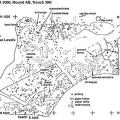
Mound AB, Trench 39N bead debris

  • Mound AB, Trench 39N bead debris

This plan shows concentrations of bead manufacturing debris on several superimposed Ravi phase floor levels that indicate the positions of actual work areas. >

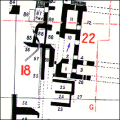
Mohenjodaro, D.K. Area, G Section

  • Mohenjodaro, D.K. Area, G Section

Mackay writes about the large building in Block 22 (p. 152): "At the floor level of the Late II Phase this building measured 51 feet 3 inches, North-South, by 56 ft. long at the north and about 54 feet 9 ins. at the south. The thickness of its wa… >

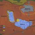
Map of Harappa archaeological site

  • Map of Harappa archaeological site

The excavation map is defined by the Harappa Archaeological Research Project, and shows the extent of occupation phases during different chronological phases. The major excavation areas featured in this presentation are Trenches 38, 39 and 42 on Mou… >

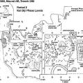
Plan of Kot Diji phase levels

  • Plan of Kot Diji phase levels

Plan view of Trench 39N Kot Diji phase levels (Period 2: 2800-2600 BC) with locations noted for major finds: sealing, elephant seal, inscribed sherds, limestone weight. This area appears to have been a street running between mud-brick structures. Ha… >

Pagination

  • First page
  • Previous page
  • Page 1
  • Page 2
  • Page 3
  • Page 4
  • Page 5
  • Next page
  • Last page
Seal, Mohenjo-daro
© Harappa.com 1995-2026 31