Home

Main navigation

  • home
  • slides
  • essays
  • articles
  • books
  • video
  • q & a
  • blog
Secondary menu
  • about us
    • scholars
    • privacy
    • support
    • image rights
    • credits
    • contact us
  • resources
  • ◀
  • 90 of 90
Around the Indus in 90 Slides 2

Late Harappan Localization Era Map

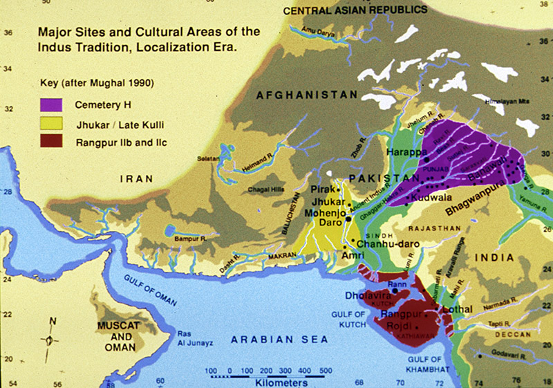
This map shows the major cultural interaction regions c. 1900-1300 BC: Cemetery H in the north, Jhukar in the south and Rangpur in Gujarat. During this period there were still urban centers in the Punjab and Sindh, but there was a breakdown in trade from the coast to the northern regions and from the northwestern mountains to the plains.

Maps
Harappa
Photograph
Harappa Archaeological Research Project
© Harappa.com 1995-2026 31