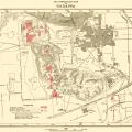
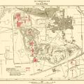
"As already stated, the principal mounds form a rough parallelogram. designated AB, E, and the one occupied by the present town are higher and larger than Mounds F, D and the Thana Mound." >
This map of Harappa was published by Madho Sarup Vats in his 1941 monograph on Harappa Excavations at Harappa: Being an account of archaeological excavations at Harappa carried out between the years 1920-21 and 1933-34. Volume I - Text; Volume I…>
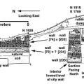
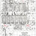
Plan view of the so-called "granary" or "parallel-wall structure" on Mound F at Harappa indicating areas of HARP excavations conducted in 1997 and 1999. Note that the structural remains surrounding the "granary" are, for the most part, later than th… >
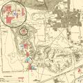
This map shows both Mound F and Mound AB, in grey circles, within the context of the larger site excavations. Objects that follow were found in both or either of these two areas and which in particular may not be available in the archival record. … >


")