Home

Main navigation

  • home
  • slides
  • essays
  • articles
  • books
  • video
  • q & a
  • blog
Secondary menu
  • about us
    • scholars
    • privacy
    • support
    • image rights
    • credits
    • contact us
  • resources

Black and White Ancient Indus Civilization Images

Mohenjo-daro Countryside

Aerial View of Mohenjo-daro [107A]

  • Aerial View of Mohenjo-daro

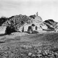
Aerial View from South Early Aerial view of the Citadel Mound at Mohenjo-daro (looking south), showing the excavations in SD area prior to the work conducted by Wheeler in 1950. A path and stairs lead from the musum campus area to the stupa on th… >

Mohenjo-daro Citadel Gateway [110]

  • Mohenjo-daro Citadel Gateway

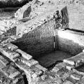
ACC - Citadel Gateway Southeast Room associated with the massive fired brick walls at the southeastern corner of the Citadel Mound. Wheeler identified this structure as a fortification wall and postern gate. No. 110 also 1114… >

Mohenjo-daro Citadel Gateway Excavations [112]

  • Mohenjo-daro Citadel Gateway Excavations

ACC - Citadel Gateway Southeast Excavations of the gateway area viewed from the southeast, looking northwest. The brick walls and rooms have been fully exposed. See slide 26Q for a view from the north. No. 112 >

Northwest Corner, Granary Excavations, Mohenjo-daro [13B] (138?)

  • Northwest Corner, Granary Excavations, Mohenjo-daro

REM Granary Overlooking the northwest corner of the REM Granary excavations. A stairway indicates the presence of a second story. Square voids in the edges of the walls are where wooden posts would have been built into the brick foundation to sup… >

Pottery

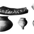
Photographed between 1922-27 and published in Sir John Marshall, Mohenjodaro and The Indus Civilization (1931). >

Panoramic view of north-west part of VS Area, from west

Photographed between 1922-27 and published in Sir John Marshall, Mohenjodaro and The Indus Civilization (1931). >

K.N. Dikshit (CLOSE)

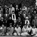
  • K.N. Dikshit 16

Mohenjo-daro Parapet Walk

Mohenjo-daro parapet walk between two of the towers at the south-eastern corner of the citadel (p. 49). >

Mound E Tunnelling by Villagers + Map

In addition to the excavations at Mound F and Mound AB, Daya Ram Sahni had this photograph taken in 1921 of Mound E [Map, Image 2 above, although this is not considered very accurate today]. Sahni noted in another area how extensively the site had b… >

Pagination

  • First page
  • Previous page
  • …
  • Page 12
  • Page 13
  • Page 14
  • Page 15
  • Page 16
  • Page 17
  • Page 18
  • Page 19
  • Page 20
  • …
  • Next page
  • Last page
© Harappa.com 1995-2026 31