Home

Main navigation

  • home
  • slides
  • essays
  • articles
  • books
  • video
  • q & a
  • blog
Secondary menu
  • about us
    • scholars
    • privacy
    • support
    • image rights
    • credits
    • contact us
  • resources
  • see 17 slide essays ▶

An examination of the natural landscape and stratigraphy of the Beas settlement from the Ancient Indus Valley people, essay by Rita Wright

Beas Landscape and Settlement Survey

Rita P. Wright
Joseph Shuldenrein
M. Rafique Mughal

Between 1992 and 1996 the Punjab Archaeological Survey (PAS), under the direction of the Government of Pakistan, Department of Archaeology, conducted a large-scale survey in order to identify all ancient settlements in the Punjab. Surface surveys at a small number of the settlements identified diagnostic artifacts that were contemporary with the Indus civilization. >

The Site of Vainiwal

Rita P. Wright
Joseph Shuldenrein
M. Rafique Mughal

Vainiwal was first identified by M. Sharif (1989) prior to the PAS. It is located approximately 100 km upstream of the Beas confluence with the present Chenab (Figure 3). While other mounded sites occupied the Bari Doab (see Lohoma Lal Tibba below), the doab topography grades almost imperceptibly to the Holocene alluvial plain at Vainiwal. The most prominent features of the… >

Sampling and Recording of Surface Materials

Rita P. Wright
Joseph Shuldenrein
M. Rafique Mughal

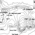
The map in Figure 1 shows the distribution of 5 x 5 m collection units and 71 quadrats (the larger units shown) that were the basis for selecting a system of random sampling within each quadrat, thus providing a maximum coverage of the entire mound. Within each 5 x 5 m unit we weighed and counted all surface artifacts, including ceramic sherds, fired clay nodules and terracot… >

Test Trench and Chronology

Rita P. Wright
Joseph Shuldenrein
M. Rafique Mughal

The development of a site chronology is partially based upon a 3 m deep test trench on the interior portion of the central mound (Figure 7). Discrete cultural strata were isolated. They included reworked cultural fills, features (hearths, firing sites, burnt floors), remnants of standing water and silty sands, and mudbrick courses or walls. The lowermost occupation horizon w… >

The Site of Chak 90-12L

Rita P. Wright
Joseph Shuldenrein
M. Rafique Mughal

The site of Chak 90-12L is one of the larger sites found along the Beas, at 7.5 hectares. Figure 8. It is surrounded by housing and cultivated fields and has undergone significant modification since the time of its first discovery by the PAS and the two visits the Beas team made to the site. Tractors are the principal earth moving device. During our first visit we noted cl… >

The Sites of Lohoma Lal Tibba and Chak Purbane Syal

Rita P. Wright
Joseph Shuldenrein
M. Rafique Mughal

Lohoma Lal Tibba (19 km. from Harappa), Chak Purbane Syal (23 km.) and Harappa form a small cluster of settlements at the upstream end of our survey area. Lohoma Lal Tibba is a highmounded site with a current elevation of a maximum elevation of 4.5. m, though local villagers informed us that the site was 2 m higher a decade ago. Currently, it is bisected by a dirt road that le… >

The Mapping Project and Systematic Collections at Lohoma Lal Tibba

Rita P. Wright
Joseph Shuldenrein
M. Rafique Mughal

The two primary materials discovered in the assemblage at Lohoma Lal Tibba are nodules and sherds. The largest concentrations of nodules are on the south mound as shown on Figure 10. At Harappa, these highly vitrified nodules, often combined with ash were used as fill or foundational materials in residential buildings. Their higher densities on the south mound (over 25 kilo… >

Test Trenches and Radiocarbon Determinations

Rita P. Wright
Joseph Shuldenrein
M. Rafique Mughal

Seven radiocarbon determinations can be correlated with the above sequence, including those from non-cultural levels. They are the first dates for this region with which to reconstruct environmental conditions before the onset of settlement. At Lohoma Lal Tibba, three are from a test trench and one from a pyrotechnical feature on the south mound and a carbon deposit on th… >

Radiocarbon Determinations and the Beas Drainage

Rita P. Wright
Joseph Shuldenrein
M. Rafique Mughal

As discussed in the above, central to the research was a robust program of the collection of organic sediments and carbon. The latter have been discussed in the context of cultural deposits at Vainiwal and Lohoma Lal Tibba with respect to the onset and duration of settlement. This discussion of the radiocarbon dates follows the order of the location of Beas related archaeo… >

Insights from Remote Sensing

Rita P. Wright
Joseph Shuldenrein
M. Rafique Mughal

A project of remote sensing utilizing Corona Declassified and Satellite Imagery was designed to integrate ground collected survey with remote sensing data in order to enhance our picture of the Beas regional landscape. Utilization of Corona imagery has been a successful approach to observing relict settlements and river channel changes in order to reconstruct human-environm… >

Pagination

  • Page 1
  • Page 2
  • Next page
  • Last page
© Harappa.com 1995-2026 31