
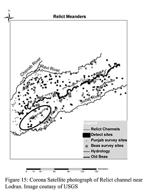
A project of remote sensing utilizing Corona Declassified and Satellite Imagery was designed to integrate ground collected survey with remote sensing data in order to enhance our picture of the Beas regional landscape. Utilization of Corona imagery has been a successful approach to observing relict settlements and river channel changes in order to reconstruct human-environment interactions. Data derived from these sources and our interpretations, obviously, require on-the-ground investigation to confirm them. The map shown on Figure 15 is a layered landscape showing relict channels and archaeological sites. The Beas hydrology is shown in white and relict channels in light grey. Of particular interest to our project is the identification of a relict channel near the Lodhran region, where five Beas sites have been discovered that are some distance from the current dry bed. This landscape feature may partially resolve the nature of settlement in this area if confirmed by on-the-ground survey.
