
"In the northern portion of this mound, Rai Bahadur Daya Ram Sahni excavated a considerable area (B) in the years 1920-21, 1923-24 and 1924-25. He began by sinking a trial trench 55 ft. long by 20 ft. wide, a little to the west of and parallel to the tomb of Naugaza. This trench was extended to a length of over 160 ft., and later on, at right angles to it, he sank two subsidiary trenches towards the west which cut across the highest portion of the mound, the northern one distinguished as D trench, and the southern one as Bg. On these being linked up the whole excavation was called B (PI. XXIX). This area is now an irregular polygon measuring some 160 ft. from east to west by 100 ft, from north to south increasing to 160 ft. along the eastern side.
From the highest point — 590 ft. above the sea-level — the ground covered by this excavation falls some 20 ft. in level towards the south and east (PI XXIX, Section of Trench B), so that for a space of about 40 ft, along its eastern edge we come almost at once to the IVth stratum of remains, without encountering any of the three upper strata. On the other hand, in the middle part of this area, the IVth stratum is reached at a depth of 12 to 21 ft. below the surface. To avoid confusion on the part of the reader, a word must be said here in regard to the method of recording followed during the time of the Rai Bahadur. It appears that the depth of antiquities was then recorded sometimes from the highest point of the mound, that is to say from 590 ft. above the sea-level, and at others from the surface of the ground at the point where the find was made, which, as already mentioned, might be as much as 21 ft. lower."
- Madho Sarup Vats, 1940. Excavations at Harappa: Being an account of archaeological excavations at Harappa carried out between the years 1920-21 and 1933-34. Volume I - Text; Volume II - 139 Plates., pg 137.
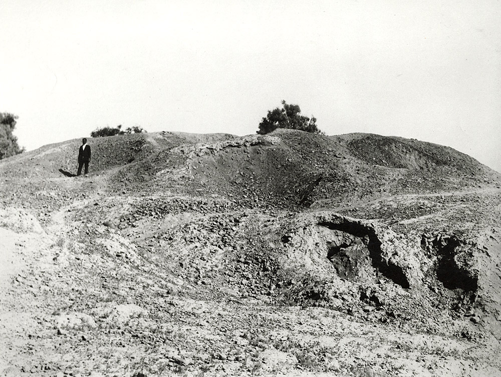
This photograph shows the area at the northeastern edge of the high mound that had trenches designated B in the north and A in the south. Eventually this whole mound came to be referred to as Mound AB. The photo shows some collapsed tunnels from brick robbing in the foreground and a very irregular topography resulting from the extensive removal of brick structures from this area. In one of the earliest accounts of this part of the site, https://www.harappa.com/content/charles-masson-1829">Charles Masson mentioned the presence of many large brick buildings.
The photographer is looking west and is probably standing just in front of the tomb of the saint, Baba Noor Shah Wali.
- Jonathan Mark Kenoyer, 2023.