
Trench B is the name given to a series of trenches dug in mound A-B over successive seasons by Dara Ram Sahni between 1921 and 1925. (See below for details in Vats' account)
"The operations were then shifted to the mound marked A—B in General Cunningham's plan, on the east side of which some trial diggings had been carried out in the year 1920-21. The object of this year's work was to obtain a general idea of the stratification of this lofty mound before operations on a larger scale were embarked on. For this purpose a trench about 140 feet long and 23 feet wide was drawn in continuation of the previous excavations referred to above. Two other trenches were also sunk at right angles to it towards the west. Owing to the deep accumulation of earth and insufficiency of funds the virgin soil could not be reached anywhere. A portion of the main trench was, however, carried to a depth of some 20 feet above the surrounding fields or about 35 feet below the highest point of the mound. This resulted in the determination of as many as seven successive layers of buildings indicating a very prolonged occupation of the site with no doubt, other strata still unexposed below them."
- Daya Ram Sahni, 1926. Annual Report Of The Archaeological Survey Of India 1923-24, pg 53. No corresponding image.
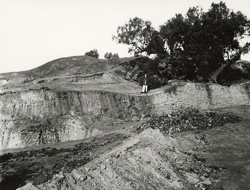
"In the northern portion of this mound, Rai Bahadur Daya Ram Sahni excavated a considerable area (B) in the years 1920-21, 1923-24 and 1924-25. He began by sinking a trial trench 55 ft. long by 20 ft. wide, a little to the west of and parallel to the tomb of Naugaza. This trench was extended to a length of over 160 ft., and later on, at right angles to it, he sank two subsidiary trenches towards the west which cut across the highest portion of the mound, the northern one distinguished as D trench, and the southern one as Bg. On these being linked up the whole excavation was called B (PI. XXIX). This area is now an irregular polygon measuring some 160 ft. from east to west by 100 ft, from north to south increasing to 160 ft. along the eastern side.
From the highest point — 590 ft. above the sea-level — the ground covered by this excavation falls some 20 ft. in level towards the south and east (PI XXIX, Section of Trench B), so that for a space of about 40 ft, along its eastern edge we come almost at once to the IVth stratum of remains, without encountering any of the three upper strata. On the other hand, in the middle part of this area, the IVth stratum is reached at a depth of 12 to 21 ft. below the surface. To avoid confusion on the part of the reader, a word must be said here in regard to the method of recording followed during the time of the Rai Bahadur. It appears that the depth of antiquities was then recorded sometimes from the highest point of the mound, that is to say from 590 ft. above the sea-level, and at others from the surface of the ground at the point where the find was made, which, as already mentioned, might be as much as 21 ft. lower."
- Madho Sarup Vats, 1940. Excavations at Harappa: Being an account of archaeological excavations at Harappa carried out between the years 1920-21 and 1933-34. Volume I - Text; Volume II - 139 Plates., pg 137. Image Pl. XXIX.
This view of Trench B shows a pile of brick rubble in the center of the trench, with a diagonal wall with rubble in the foreground. The sections of the excavation trench do not show any traces of large walls, as this area was heavily looted for bricks.
- Jonathan Mark Kenoyer, 2023.