Home

Main navigation

  • home
  • slides
  • essays
  • articles
  • books
  • video
  • q & a
  • blog
Secondary menu
  • about us
    • scholars
    • privacy
    • support
    • image rights
    • credits
    • contact us
  • resources

Mound AB

Harappa Mound AB Related Slides. Mound AB is apparently the oldest and was the first Mound at Harappa to be excavated.

Mound AB, Harappa

  • Mound AB, Harappa

The high mound at Harappa (Mound AB) is surrounded by a massive mud brick city wall with large square ramparts. One of these eroding ramparts is visible through the underbrush that now covers the site. The flags mark the tomb of a Muslim saint that … >

Kot Diji & Harappa phase levels

  • Kot Diji & Harappa phase levels

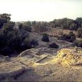
North end of Harappa Mound AB, looking down on the Kot Diji phase levels from the heights above the Harappa phase baked brick wall (on the right) that has been covered with protective plaster for conservation. In the background (to the North) is Mou… >

Harappa Mound AB From Crop Fields

  • Harappa Mound AB From Crop Fields

Mound AB, whose origins actually go back five and a half thousands years to 3500 BCE, seen from the rich crop fields that surround many ancient Indus cities including Mohenjo-daro and Dholavira. >

Public well, Harappa

  • Public well, Harappa

A large public well and public bathing platforms were found in the southern part of Mound AB at Harappa. These public bathing areas may also have been used for washing clothes as is common in many traditional cities in Pakistan and India today. >

Harappa phase building remains

  • Harappa phase building remains

Top of the northern end of Harappa Mound AB. Brick robbing has removed all of the large walls of substantial Harappa phase buildings, leaving the massive void visible on the right. Smaller divider walls and thresholds were often overlooked, allowing… >

Mound AB Center Area

  • Mound AB Center Area

A closer view of a room or the side of a building on Mound AB, Harappa. >

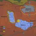
Map of Harappa archaeological site

  • Map of Harappa archaeological site

The excavation map is defined by the Harappa Archaeological Research Project, and shows the extent of occupation phases during different chronological phases. The major excavation areas featured in this presentation are Trenches 38, 39 and 42 on Mou… >

Rubble paving and Ringstones

  • Rubble paving and Ringstones

A paving of brick rubble and broken ring stones, dating to late in the Harappa phase, was found on top of Mound AB to the west of the wall void shown in 50. >

West of Naugaza Tomb after Excavations

  • West of Naugaza Tomb after Excavations

"My operations did, in­deed, reveal portions of a large brick building, but unfortunately they were found to have been so badly hacked about by brick diggers that it is well nigh impos­sible to determine its real nature or date, Plate VIII, Photo. N… >

Trench 39 North Excavations

  • Trench 39 North Excavations

Excavations on Mound AB in 1998 began with the clearance of surface debris to expose the many habitation levels, beginning with natural soil in the lower foreground. This view shows almost 1700 years of superimposed occupation levels beginning aroun… >

Pagination

  • First page
  • Previous page
  • Page 1
  • Page 2
  • Page 3
  • Page 4
  • Page 5
  • Next page
  • Last page
Unicorn Seal, Mohenjo-daro
© Harappa.com 1995-2026 31