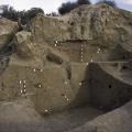
Excavations in Trench 39 South on Mound AB in 1996 revealed an extensive deposit of the Kot Diji phase occupation dating to between 2800 and 2600 BC. A geometric button seal (38) was found in the upper part of this rectangular Trench 39 South. White… >
The paleotopography represents the pre-occupation topography as it may have existed about 5000 years ago. There may be some areas in the paleotopographic model that may not represent the actual paleotopography, but rather subsequent anthropogenic in… >
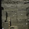
Looking up from the bottom of Trench 39S one can see habitation levels spanning over 500 years from approximately 3300 BCE at the bottom to 2800 BCE at the top. The white arrow pointing north is lying at the edge of a large storage pit dug into natu… >
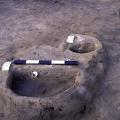
During the Ravi Phase (circa 3300-2800 BCE) the earliest inhabitants lived in huts made of wooden posts probably covered with reeds and clay. They stored grain and other foodstuffs in small bell shaped pits that were plastered with fine clay. The wh… >
The winter sun rises over the site while the mist clings to the mounds. The mounds of the "lower town" are barely visible above the mist and in the foreground are the edges of brick structures belonging to the Buddhist monastery complex on the "cita… >
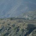
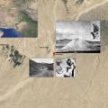
"Jean-Marie [Casal] pointed. 'There in front you see Siah Sang Pass—that is, Black Stone Pass.' "We had turned north towards a line of low, black mountains splashed with one white patch. As we drove into the black hills, a feeling of foreboding … >
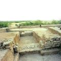
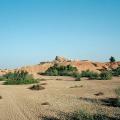
The eroded edges of the "citadel" mounds are covered with red brick dust and pottery, with traces of lighter mud brick revealing the underlying platforms that form the foundations of the uppermost buildings. This mound is encircled by a massive mud-… >