Home

Main navigation

  • home
  • slides
  • essays
  • articles
  • books
  • video
  • q & a
  • blog
Secondary menu
  • about us
    • scholars
    • privacy
    • support
    • image rights
    • credits
    • contact us
  • resources

Ancient Indus Valley and related civilization citadel excavations

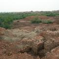
Mohenjo-daro Citadel Gateway Excavations [112]

  • Mohenjo-daro Citadel Gateway Excavations

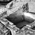
ACC - Citadel Gateway Southeast Excavations of the gateway area viewed from the southeast, looking northwest. The brick walls and rooms have been fully exposed. See slide 26Q for a view from the north. No. 112 >

Farmlands to the west of Mohenjo-daro

  • Farmlands to the west of Mohenjo-daro

West of the "citadel" mound are lush farmlands watered by modern irrigation channels. A levee protecting the site from annual floods divides the irrigated land from the salt encrusted sediments surrounding the ancient site. The high salinity of the … >

Mohenjo Daro Lower Town: VS Area

  • Mohenjo Daro Lower Town: VS Area

A view of the houses and streets in VS area, with the citadel and stupa mound in the background. The tops of eroding buildings have been capped with a protective layer of mud brick that will help to soak up the efflorescent salts and protect the und… >

Mohenjo-daro Lower Town: HR area and Stupa

  • Mohenjo-daro Lower Town: HR area and Stupa

This general view of houses in HR area shows the color of the brick walls prior to use of mud brick and clay slurry for conservation. The lower parts of the walls have the natural reddish color of fired brick. >

Mohenjo-daro Lower Town: VS area and Stupa View

  • Mohenjo-daro Lower Town: VS area and Stupa View

This general view of houses in VS area shows the color of the brick walls after the use of mud brick and clay slurry for conservation. The lower parts of the walls have the natural reddish color of fired brick and the upper portion is oliveÐgrey mud… >

Mohenjo-daro Lower Town: Main Street HR/VS area and stupa view

  • Mohenjo-daro Lower Town: Main Street HR/VS area and stupa view

Standing in HR area and looking northwest at the juncture of Last Street (east west) and First Street (north south). VS area is seen on the other side of the street and the stupa mound rises in the background. Stacks of mud bricks are waiting to be … >

Conservation of brick walls in DK - G Area, Lower Town

  • Mohenjo-daro Conservation of brick walls in DK - G Area, Lower Town

One relatively successful low cost techniques used to combat the destructive nature of salts in the fired bricks is to cover the walls with a thick layer of mud and straw plaster and to spray them with clay slurry. When the salts percolate to the su… >

Eroded surface of the mound DK-I Area

  • Mohenjo-daro, Eroded surface of the mound DK-I Area

The pathway leading from VS to DK-I area follows the natural topography of the mounds. The eroding surface is littered with over fired nodules, pottery, brick fragments and other artifacts that are heavily encrusted with efflorescent salts. >

Room in between L and SD Areas

  • Mohenjo-daro, Room in between L and SD Areas

Narrow brick walls define the outlines of a small room or courtyard in the low-lying area between L and SD Areas on the Citadel Mound. A standard size of mud brick and baked brick (7 x 14 x 28 cm) was used in house construction, and a different size… >

Pagination

  • First page
  • Previous page
  • Page 1
  • Page 2
© Harappa.com 1995-2026 31