

The field research included the following:
1. Systematic mapping and collection of artifacts at all Beas sites.
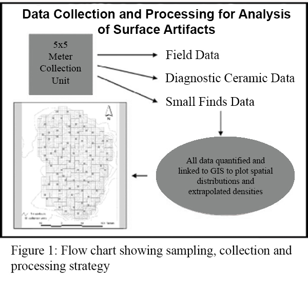
The methodology included mapping contours and creating a surface grid for each site. This 5 x 5 m grid was the basis for collecting a random sample of surface finds, which was designed to provide maximum coverage. Figure 1 illustrates the methodology, using the site of Vainiwal as an example. The method was utilized at all survey sites with the exception of those that had been almost totally destroyed. In those instances, we prepared field maps, scraped surfaces to identify remnant features, and where possible, collected a modified random sample of surface finds. An example of this strategy is described below in a section on the site, Chak 90-12L:
All recorded objects remained in situ in the units from which they were collected, with the exception of diagnostic materials and small finds. Ceramics were recorded in a pottery database. The artifactswere stored in a secure storage area at Harappa. Whole vessels, unique types, and small finds were accessioned and turned over to the Curator at the Harappa Museum
2. Documenting Surface Features.
In addition to weighing and recording all materials, our maps also included surface features, such as installations, streets, walls, kilns, outlines of buildings, mud brick constructions, and other activity areas.
3. Test Trenches
A limited program of test trenching was implemented in order to establish a relative and absolute chronology at specific sites. These data provided checks against the surface- and artifact-based chronology.
4. Site Formation Processes.
In order to determine whether the materials recovered had been subject to patterned erosion and the current artifact and feature distribution reflected site abandonment or post-abandonment sedimentation and erosion trends, two surface transects were run across selected sites and field measurements made using compass and tape.
5. Sub-surface Probing.
In addition to documenting site sizes and cultural remains, we conducted sub-surface probing in order to reconstruct site landscape elements and stratigraphic contexts. Sub-surface probing involved collection of 3-meter long cores of cultural and/or alluvial sediment from the substrate at the edge of mounds and at nearby locations.
6. Beas River Crossings.
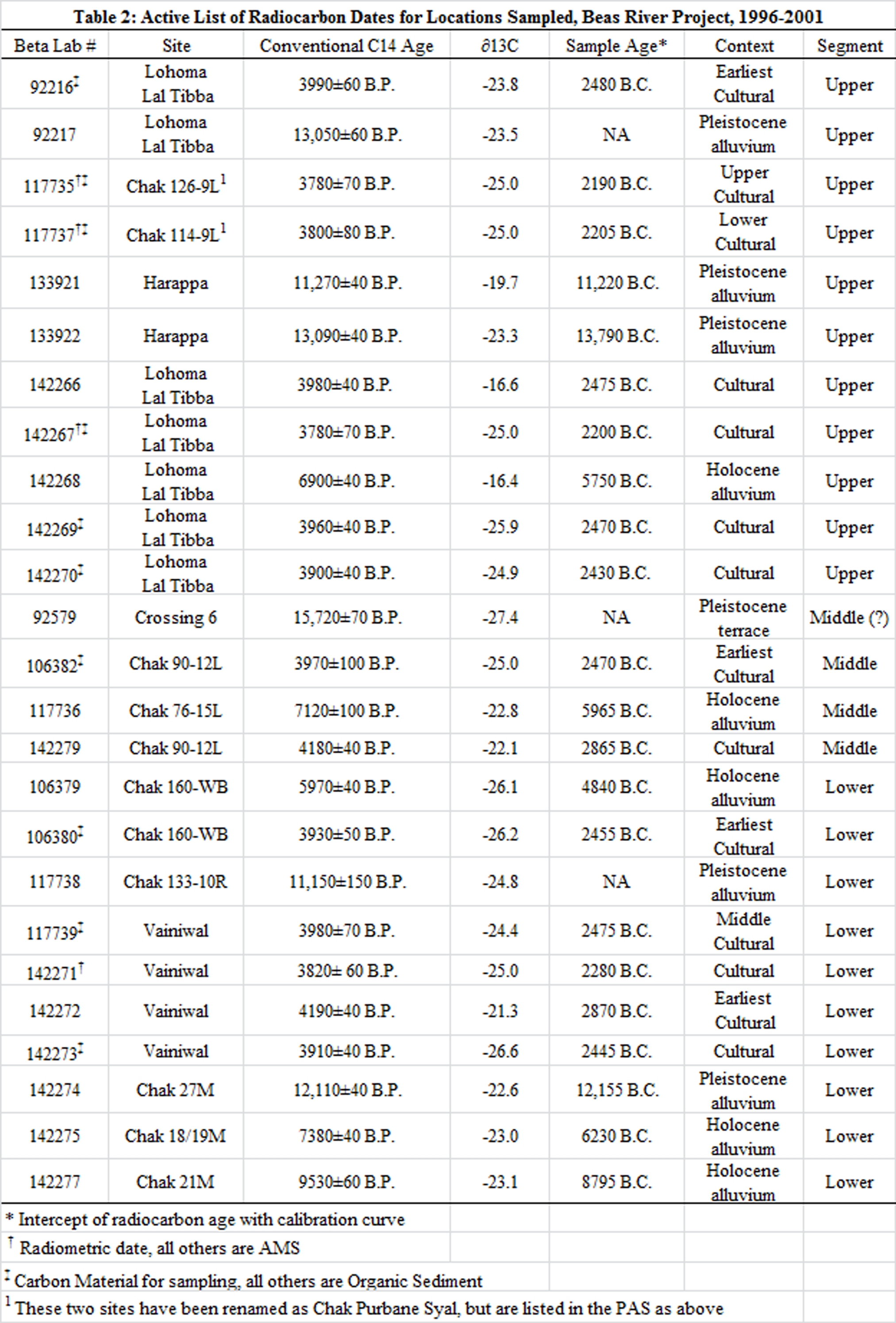
We also inspected a total of twelve Beas River crossings accessible by a four-wheeled vehicle. Profiles of embankments and diagnostic cross sections of the floodplain were mapped and described sedimentologically. Organic materials from cores and profiles within the floodplain system, such as the remains of an ancient terrace at Crossing 6 (see below Table 2 and discussion of RC Dates), were collected. Our expectation was to merge mound construction, chronology and stratigraphy with the geomorphological history of the plain.
7. Remote Sensing and Corona Imagery.
This aspect of our methodology integrated our ground collected survey and remote sensing data in order to develop a more complete picture of the riverine environment and settlement beyond what was possible based on ground survey alone. This aspect of our research is in the initial stages but has yielded promising results. They are briefly described in the section on Insights from Remote Sensing, later in the paper.