Home

Main navigation

  • home
  • slides
  • essays
  • articles
  • books
  • video
  • q & a
  • blog
Secondary menu
  • about us
    • scholars
    • privacy
    • support
    • image rights
    • credits
    • contact us
  • resources

Slides on 3D models and recreations of the ancient Indus Valley by Wayne Belcher

Mound E/ET Gateway on Southern Wall

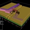
The structures located at the southeastern corner of Mound E consists of a complex of massive baked brick/mud brick walls and baked brick drain complex. This series of structures is set between the southeastern corner of the mud brick city wall of M… >

Mound E Gateway Reconstruction

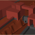
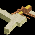
The overall gateway structure, including the street and side drains is bonded at either edge (east and west) by massive mud brick bastions, representing the Mound E and Mound ET perimeter walls. The area between these two mud brick perimeter walls w… >

Mound E Gateway Artists Conception

Photograph of gateway excavations, 1995. A series of side rooms were also excavated along the eastem edge of the gateway in 1995. The latest phase of construction also included a large east-west oriented doorway leading through the eastem edge of… >

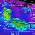
Original Mound Paleotopography

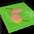
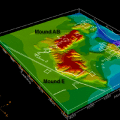
The paleotopography represents the pre-occupation topography as it may have existed about 5000 years ago. There may be some areas in the paleotopographic model that may not represent the actual paleotopography, but rather subsequent anthropogenic in… >

Period I Cultural Stratigraphy

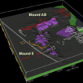
Using maps and cross-sections of the cultural deposits from HARP, surfaces were generated to represent the interfaces of cultural layers in the mounds at Harappa. This represents the growth of the city of ancient Harappa vertically and through time… >

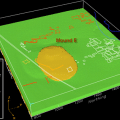
Period II Cultural Stratigraphy

Period 2 deposits represent a transition phase between pre urban and urban phases and exist primarily beneath Mound E. >

Period IIIA Cultural Stratigraphy

Period 3A deposits, representing an early urban phase, exist beneath Mounds E and also show expansion onto the area beneath Mound AB. Growth in the city of Harappa is shown to be both lateral and vertical. >

Period IIIBC Paleotopography

Period 3B and 3C deposits essentially cover the entire modeled area and represent the greatest extent of the ancient urban center. J. M. Kenoyer has developed a model describing some of the processes that contribute to the urban growth at Harappa… >

Period IV-V Paleotopography

Periods 4 and 5, representing a modification of cultural styles, exist at the tops of Mounds AB and E. >

Periods I-V Stratigraphic Cross-Section

Period IV-V 1900-1700 B.C. Period IIIBC 2450-1900 B.C.Period IIIA 2600-2450 B.C.Period II 2800-2600 B.C.Period I 3300-2800 B.C. Pre-Occupation before 3300 B.C. The purpose of this continuing research is to develop a system for… >

Pagination

  • Page 1
  • Page 2
  • Next page
  • Last page
© Harappa.com 1995-2026 31