September 25th, 2016
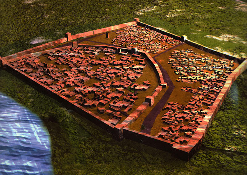
"The centralized planning of the Harappan settlements," writes the archaeologist write Dilip Chakrabarti, "is one of their most famous features. Although they were not laid strictly on chessboard patterns with invariably straight roads, they do show many signs of careful planning. Places like Mohenjodaro, Harappa, and Kalibangan had low, large eastern sectors and separately walled, higher but smaller western sectors. There is clear evidence that the buildings of western sectors were laid out on a high artificial mud platform (80,000 square metres and 7 metres high in the case of Mohenjodaro), fortified with bastions and towers. The eastern sector too lay within a wall but the scale of fortification here was less impressive.
"The practice of putting a wall around a settlement dates to the Early Harappan period but its division into two separately enclosed sectors appears to coincide with the Mature Harappan stage. Because the western sector is raised higher than the eastern one and it is enclosed, archaeologists suggest that it may have been reserved for public buildings, the performance of ceremonies, and the residences of the elites. The rest may have dwelt in the eastern sector which had closely built burnt-brick or mud-brick houses lining streets which are often more than ten metres wide and lanes which are less than two metres wide. The multi-roomed houses arranged around courtyards sometimes possess more than one storey, but there are examples of single-roomed, single-storyed buildings.
"Some excavated sites such as Surkotada show no evidence of twin sectors, having only a single sector on the model of the western sector of Kalibangan. Lothal and Banawali each lay within a single enclosure wall. In Banawali, the main streets were winding rather than straight . ..."
Dilip Chakrabarti, Ed. Indus Civilization Sites in India New Discoveries, pp. 12-13.
Wikipedia entry on Banawali

